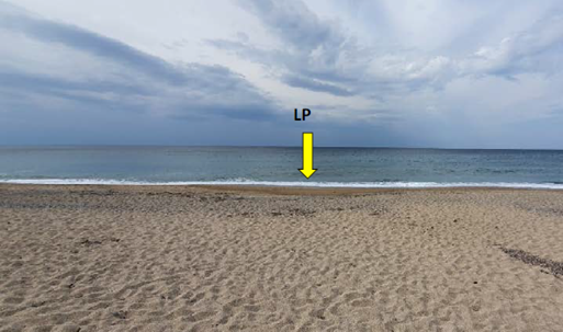
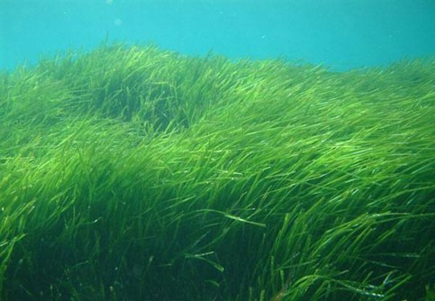
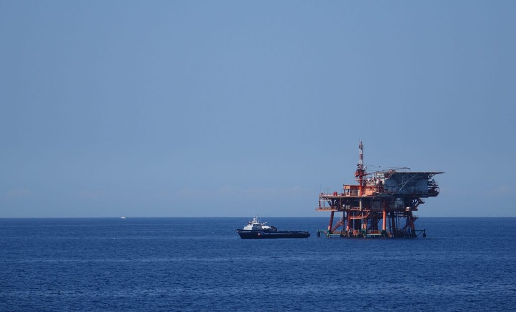

We can easily imagine that, when planning the construction of a motorway, one needs to garner information about the features along the route: maps, topography, geology, vegetation and wildlife, existing infrastructures and human activities along the path… Well, things are not so different when planning a submarine cable route, where you will encounter similar features like ridges, canyons, cliffs, plateaus, basins or meadows. There are no cities underwater (yet), but people navigate, fish, perform military maneuvers and extract oil and gaz. A whole submarine landscape that is usually not visible to us needs to be thoroughly studied to design the route of the cable. This is done in two main steps: first with a Desktop Study that will define the route and then Marine Survey that will further refine it with very detailed measurements.
Prior to the Marine Survey, the purpose of the DTS is, based on existing information, to determine the best a-priori route for the submarine cable. The main outcome of the DTS is the Survey Cable Reference Route (SCRR), that is defined based on the following considerations which are also part of the DTS:
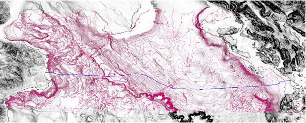
Hereafter is an excerpt of the SCRR of IONIAN (the exact location information has been hidden for the sake of confidentiality):
Each point in this table corresponds to turning points (numbered), but also singularities: we see that between points 16 and 17 there are two such features. First is the crossing of an Out of Service cable (X_Cable_OOS), and then the crossing of the Exclusive Economic Zone (EEZ[1]) limit between Italy and Greece.
In addition to determining the SCCR and a thorough analysis of each of the aspects listed above, the DTS will also provide a complete list of all the permits that will be required for the project. These are split into two broad groups: Permits in Principle that somehow validate the design of the project and grant any concession of authorize the use of public domain and Operational Permits that are required for specific activities such as the route survey, the laying of the cable and works beach during shore end operations.
| Cookie | Duration | Description |
|---|---|---|
| cookielawinfo-checkbox-analytics | 11 months | This cookie is set by GDPR Cookie Consent plugin. The cookie is used to store the user consent for the cookies in the category "Analytics". |
| cookielawinfo-checkbox-functional | 11 months | The cookie is set by GDPR cookie consent to record the user consent for the cookies in the category "Functional". |
| cookielawinfo-checkbox-necessary | 11 months | This cookie is set by GDPR Cookie Consent plugin. The cookies is used to store the user consent for the cookies in the category "Necessary". |
| cookielawinfo-checkbox-others | 11 months | This cookie is set by GDPR Cookie Consent plugin. The cookie is used to store the user consent for the cookies in the category "Other. |
| cookielawinfo-checkbox-performance | 11 months | This cookie is set by GDPR Cookie Consent plugin. The cookie is used to store the user consent for the cookies in the category "Performance". |
| viewed_cookie_policy | 11 months | The cookie is set by the GDPR Cookie Consent plugin and is used to store whether or not user has consented to the use of cookies. It does not store any personal data. |